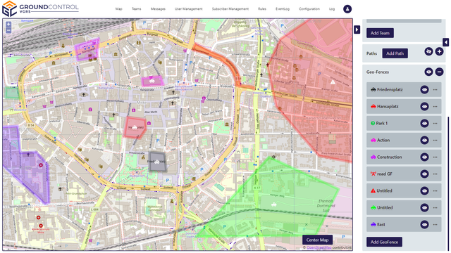
Track the units on the map. Assign icons and individual colors. Use teams to group units with similar functions
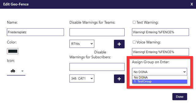
GeoFences
Create most complex GeoFences to mark special areas. Select color, icon and assign special functions triggerd by entering or leaving a GeoFence
Auto Talk Group Select
Automate talk goup selection based on the location of the user. Select the correct talk group when entering or leaving a GeoFence, following a Path or program an Event to set the trigger
MultiMap Support
GroundControl supports all common map formats like: ESRI, GeoTIFF, JPG, Google Maps, Open Street Map
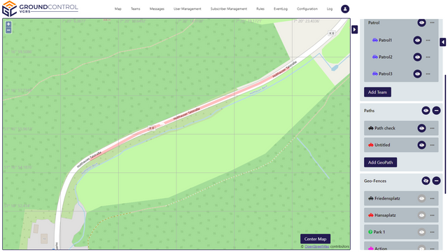
Path Monitoring
Define a path and assign special functions when entering, following or leaving it.
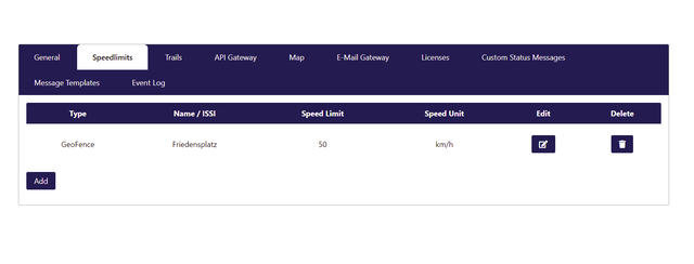
SpeedControl
Define max speed limit when moving on Paths or inside GeoFences. Notify the user when exceeding the limit and get daily speeding reports for further analysis
Audio Warnings
Play back pre-recorded audio messages directly to talk groups and radio channels